Under the wave of digital transformation of water conservancy project management, micro-technology relies on core technologies such as digital twins, the Internet of Things, and AI algorithms to createSmart Reservoir Digital Twin Platform.
The platform is built with the concept of “four fullness and four transformations”, covering single library and group library management, various reservoir types, full-scene user needs, and multiple application scenarios. By realizing the globalization of supervision and management, the visualization of leadership and decision-making, the digitization of executive management, and the ecology of public services, it provides intelligent solutions for reservoir flood control, Xingli, safety operations, and public services in the whole process.
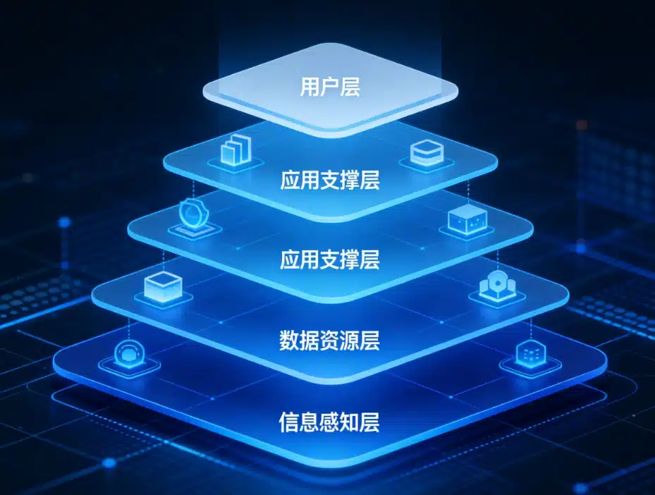
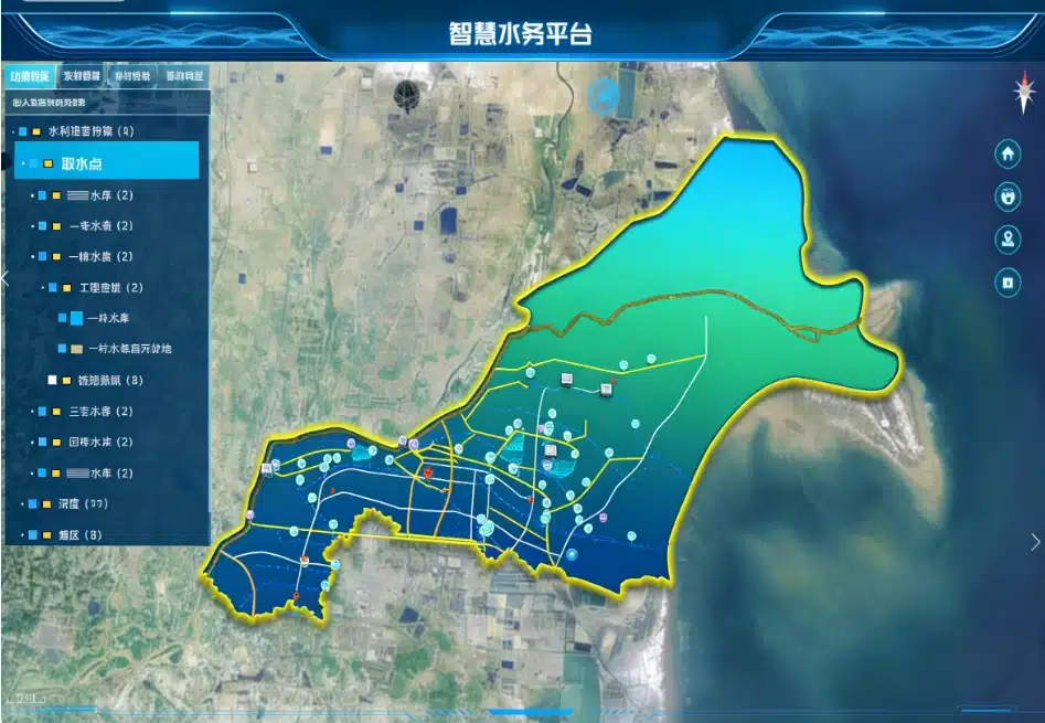
The platform builds a five-level architecture of "perception layer–resource layer–support layer–application layer–user layer" to form a closed-loop intelligent management system.
Perception layer:Comprehensively capture multi-dimensional data, including hydrological information such as meteorology, rainfall, water level, flow, and water quality, as well as industrial data such as gate status, dam seepage, and video surveillance, and realize global perception through drones, sensors, cameras, and other equipment.
Resource layer:Build a solid technical base with the support layer, relying on the big data center platform, the two- and three-dimensional integrated platform, the AI model service and the unified Internet of Things platform to complete data fusion governance, model computing and technical support to ensure the stable and efficient operation of the system.
Application layer:Integrate multiple core functions, covering all business scenarios such as monitoring and early warning, forecasting and dispatching, daily supervision, and emergency management.
User layer:It is suitable for different users such as water Conservancy bureaus, reservoir administrations, management stations, and the general public, and provides multi-terminal access methods such as desktop applications, large-screen cockpits, and mobile applications to meet the needs of differentiated use.

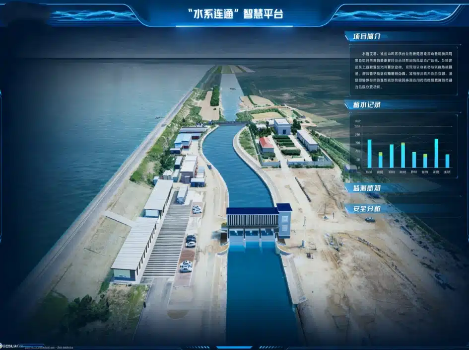
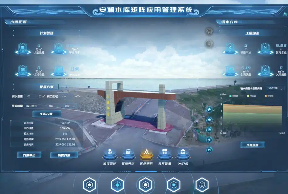
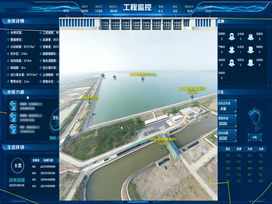
The platform uses GIS as the base map to build a “one map” visual interface, integrates real-time rain, water, and industrial data, and visually displays the distribution of rainfall in the watershed, reservoir water levels, river water level changes, and early warning information.
In view of dam safety, key indicators such as seepage, infiltration line, dam foundation pressure, and surface displacement are monitored, and real-time data updates and abnormal warnings are used to achieve early detection and early disposal of dangerous situations.
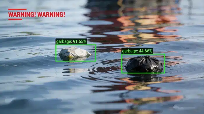
At the same time, video surveillance resources are integrated, and AI intelligent recognition technology is used to automatically monitor floating objects on the water surface, the accumulation of foreign objects on the shore, and abnormal people and vehicles in the surrounding area, greatly improving the efficiency of supervision.
Based on core algorithms such as hydrological model and hydrodynamic model, the platform realizes the integration of flood forecasting, scheduling optimization, flood evolution simulation and flood loss assessment.
Based on real-time water and rain data, multiple sets of scheduling schemes can be automatically generated and compared and analyzed, supporting precise scheduling of single reservoirs and joint scheduling of watershed group reservoirs to optimize the efficiency of flood resource utilization.
Through three-dimensional visualization technology, the process of flood evolution and the scope of inundation are dynamically displayed, and the economic losses of floods are accurately assessed, which provides a scientific basis for flood prevention and command, and effectively shortens the decision-making cycle.
The platform simplifies the daily management process of the reservoir, covering core functions such as intelligent inspection, duty management, and manual measurement and reporting.
Managers can publish inspection tasks through the PC terminal, perform reports on the mobile terminal, support multi-form records such as pictures, videos, and text, and automatically track the inspection trajectory and completion.
At the same time, it realizes functions such as one-key control of gates, real-time monitoring of water quality, and equipment maintenance records. Water quality data is visually displayed in the form of charts, and historical data query and statistical report export are supported to make daily operation and maintenance more efficient and standardized.
In terms of emergency management, the platform integrates functions such as emergency command and dispatch, flood season consultation, and downstream survey to achieve rapid response and collaborative handling of dangerous situations.
Facing the public, the platform creates a diversified service ecosystem, providing services such as flood prevention information push, water service application, cultural tourism resource recommendation, and water science mission.
Launched characteristic sectors such as ”national flood prevention“ and ”Diaoyou's Home“ to bring water conservancy services closer to people's livelihood and build a new service pattern of ”water conservancy + people's livelihood".
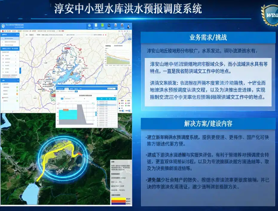
In view of the pain points of the short foreseeable period of flooding in small watersheds in the hilly areas of the Chun'an Mountains, the sudden nature, and the difficulty of dispatching, the platform creates customized solutions for the local area.
Through the addition of new water and rain sites, the collection of fine topographic data, and the establishment of a one-dimensional hydrodynamic model, an intelligent system integrating flood forecasting, scheduling simulation, and inundation analysis has been built.
The project accesses the cross-sectional data of multiple reservoirs and river channels to realize the visual simulation of downstream flood evolution and flood loss assessment, and helps managers verify the scheduling plan in advance, quickly determine the optimal flood control measures, effectively reduce the socio-economic losses caused by floods, and provide a reproducible digital template for flood control scheduling of small and medium-sized reservoirs.
The application of the smart reservoir digital twin platform has realized the transformation of reservoir management from “experience-driven” to “data-driven”.
In terms of safety and security, safety risks are greatly reduced through real-time monitoring and accurate early warning; in terms of efficiency improvement, intelligent scheduling and digital operation and maintenance are used to optimize management processes and scientific decision-making; in terms of service upgrades, we rely on diversified public services to expand the social value of water conservancy projects.
In the future, micro-technology will continue to iteratively optimize the functions of the platform to help the water conservancy industry achieve smarter, safer and more efficient modern management, and inject scientific and technological momentum into the construction of the national water safety guarantee system.